Greater Than Your Average Flood
We call the ancient lava flows of the Columbia Basin “floods” because of the great volume of basalt that they left behind. But the actual speed of the flowing lava was quite slow, and it took millions of years for that lava to erupt, spread, and cool. In contrast, the floods that came through eastern Washington during the Ice Age were catastrophic in their volume and speed.
During a period of colder climate 2.5 million to 12 thousand years ago, glaciers extended south and blocked a river now known as the Clark Fork River near Missoula Montana. Water backing up behind the ice dam formed the huge Glacial Lake Missoula. But periodically the blockage was breached, sending an estimated 500 cubic miles (2100 cubic kilometers) of water and ice crashing over hundreds of miles on its way to the ocean. The path of the floodwaters is marked by unique features that show the powerful erosive force of the water. Geologists estimate that 50 cubic miles of earth were moved in such a flood, and deposited elsewhere as gravel bars, boulder fields, and sediment on the ocean floor.
Some landforms left by the floods resemble the markings of slow-moving glaciers, but geologist J. Harlen Bretz was the first to point out that these particular features in eastern Washington told a story of something much more catastrophic. At first, Bretz’s ideas were unpopular, but another geologist’s observations on the evidence of Glacial Lake Missoula helped answer the question of where the water came from. Aerial and satellite photography makes the whole picture much clearer.
The Evidence
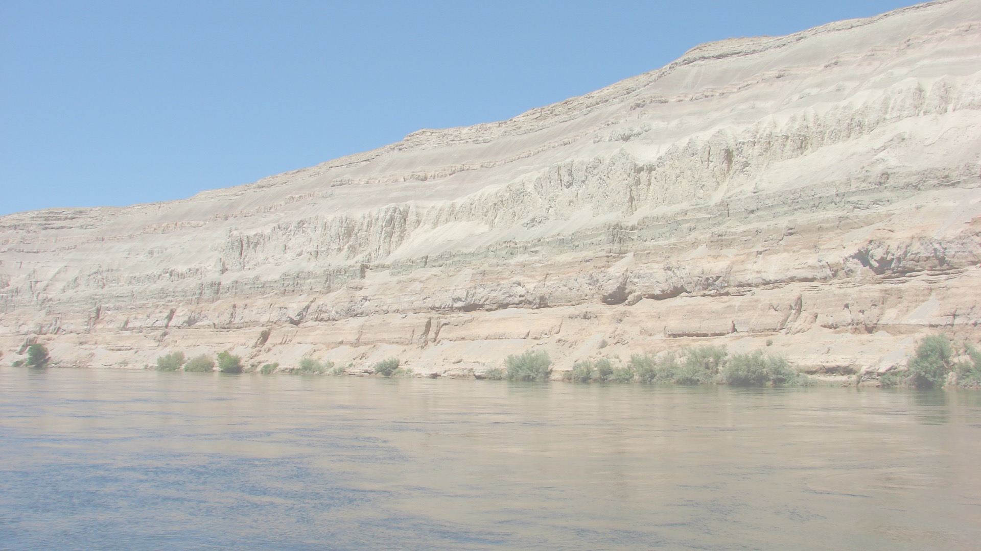
If you’ve ever played with sand and water, you’ll recognize the shapes of the landforms left by the Ice Age floods, though the scale is much larger. Rushing water makes consistent patterns as it flows around obstacles, picking up material where the current is fast and depositing it where the flow slows. Pendant-shaped flood bars are common on the Hanford Reach National Monument, and eddy scars made a curved edge where water currents rushed around mountains and slowed down. A box-shaped canyon carved by fast flooding is called a coulee, and you can find several in the area, including Ringold and Koontz Coulees north of Pasco.
Floodwaters reached a bottleneck at Wallula Gap, and water backed up into a temporary lake in the Tri-cities area, now referred to as Lake Lewis. Rocks that originated hundreds of miles away were deposited throughout the flooded area, and now give us clues as to how deep the waters were. Lake Lewis reached an altitude of 1,200 feet (366 meters) judging by the locations of these erratic boulders on the mountainsides of the Tri-cities. Sediment in these slackwater deposits also created rich soil that benefits agriculture and viticulture today.
Living things caught in the floods were deposited along with sediment and rocks, including Columbian mammoths. Dozens of excavation sites around the Lake Lewis area reveal bones of these extinct mammals, which resembled elephants but stood a few feet taller. Columbian mammoths lived in warmer climates than their woolly mammoth cousins, and lacked the shaggy fur. A Columbia mammoth is currently being excavated near Kennewick, and the soil surrounding it is being analyzed to confirm whether it was carried in floodwaters.


